Trail Walking La Chapelle-en-Valgaudémar - Refuge et Pas de l'Olan - Photo
 R@ph
R@ph

User GUIDE

© OpenStreetMap contributors
Length
Length
14.4 km
Max alt
Max alt
2730 m
Uphill gradient
Uphill gradient
1611 m
Km-Effort
Km-Effort  
36 km
Min alt
Min alt
1103 m
Downhill gradient
Downhill gradient
1615 m
Boucle
Boucle
Yes
Creation date :
2014-12-10 00:00:00.0
Updated on :
2014-12-10 00:00:00.0

(0 Reviews)

Walking
Walking
6h56
Difficulty : Difficult

Scan this QR Code to open this trail in the SityTrail application

FREE GPS app for hiking

Logo SityTrail SityTrail

IGN / Geographical institutes

Download SityTrail from the App Store Download SityTrail from Google Play

Logo SityTrail SityTrail World

The world is yours!

Download SityTrail from the App Store Download SityTrail from Google Play Download SityTrail on Huawei AppGallery

About

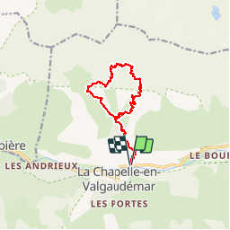
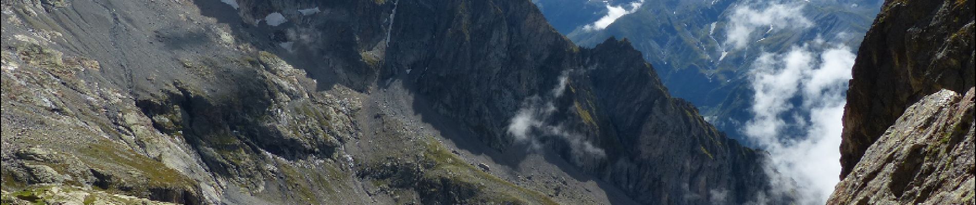
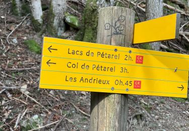
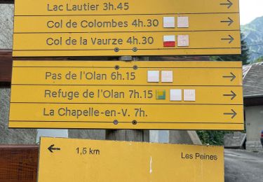
Trail Walking of 14.4 km to be discovered at Provence-Alpes-Côte d'Azur, Hautes-Alpes, La Chapelle-en-Valgaudémar. This trail is proposed by R@ph.

Description

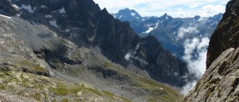
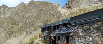
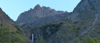
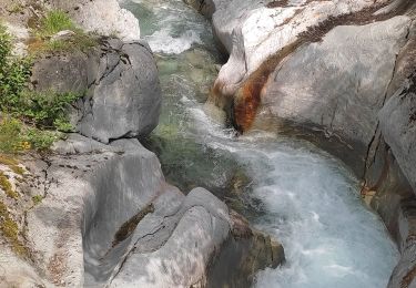
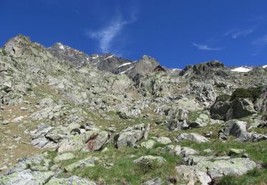
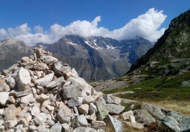
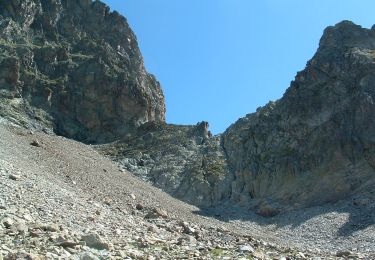
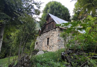
Une randonné en boucle au départ de La Chapelle en Valgaudemar. Cette balade vous permettra de découvrir la Cascade de Combefroide sur votre chemin. Elle vous ménera au refuge de l'Olan puis au pas de l'Olan à 2695m. Pour le retour vous descendrez par les Ruines et les Baumes qui vous conduiront, en suivant le torrent du clos, jusqu'à la Bourelle ou vous retrouverez le chemin initial.
Cette randonnée s'adresse aux randonneurs expérimentés l'ascension est permanente et soutenue environ 1600m de D

Elevation profile

Photos

Points of interest

Point of interest La Chapelle-en-Valgaudémar - Pas de l'Olan - Photo
R@ph
LA CHAPELLE-EN-VALGAUDÉMAR 
Point of interest La Chapelle-en-Valgaudémar - Refuge - Photo
R@ph
LA CHAPELLE-EN-VALGAUDÉMAR 
Point of interest La Chapelle-en-Valgaudémar - Le Sirac - Photo
R@ph
LA CHAPELLE-EN-VALGAUDÉMAR 
Point of interest La Chapelle-en-Valgaudémar - Cascade - Photo
R@ph
LA CHAPELLE-EN-VALGAUDÉMAR 

Positioning

Country:
France
Region :
Provence-Alpes-Côte d'Azur
Department/Province :
Hautes-Alpes
Municipality :
La Chapelle-en-Valgaudémar
Location:
Unknown
Start:(UTM)
278673 ; 4966841 (32T) N.

Trails nearby

Trail Walking La Chapelle-en-Valgaudémar - circuit de la cabane de l'aup .08-06-14 - Photo
Walking
Dervalmarc

Walking

Very easy
(1)
La Chapelle-en-Valgaudémar, Provence-Alpes-Côte d'Azur, Hautes-Alpes, France
8.8 km | 13.6 km-effort
2h 37min
Yes
Trail Walking La Chapelle-en-Valgaudémar - Tour du Vieux Chaillol 2/5 - Du Gîte Le Casset au Refuge de Vallonpierre - Photo
Walking
tracegps

Walking

Medium
(1)
La Chapelle-en-Valgaudémar, Provence-Alpes-Côte d'Azur, Hautes-Alpes, France
11.8 km | 24 km-effort
4h 30min
No
Trail Walking La Chapelle-en-Valgaudémar - Les Portes , Les cascades. - Photo
Walking
sereton

Walking

Medium
La Chapelle-en-Valgaudémar, Provence-Alpes-Côte d'Azur, Hautes-Alpes, France
8.1 km | 11 km-effort
2h 25min
Yes
Trail Walking La Chapelle-en-Valgaudémar - Refuge de Chalance - Photo
Walking
Marco05

Walking

Difficult
La Chapelle-en-Valgaudémar, Provence-Alpes-Côte d'Azur, Hautes-Alpes, France
7.5 km | 22 km-effort
5h 1min
Yes
Trail Walking La Chapelle-en-Valgaudémar - Lacs de Pétarel-Col de la Béranne - Photo
Walking
Marco05

Walking

Medium
La Chapelle-en-Valgaudémar, Provence-Alpes-Côte d'Azur, Hautes-Alpes, France
11.1 km | 23 km-effort
7h 0min
Yes
Trail Walking La Chapelle-en-Valgaudémar - Pas de l'Olan - Photo
Walking
Marco05

Walking

Very difficult
La Chapelle-en-Valgaudémar, Provence-Alpes-Côte d'Azur, Hautes-Alpes, France
12.6 km | 34 km-effort
7h 37min
Yes
Trail Walking La Chapelle-en-Valgaudémar - Valgo2 - J2 : Col de Pétarel  - Photo
Walking
ETMU5496

Walking

Very difficult
La Chapelle-en-Valgaudémar, Provence-Alpes-Côte d'Azur, Hautes-Alpes, France
18.8 km | 38 km-effort
5h 40min
No
Trail Walking Villar-Loubière - Valgo2 - J1 : Col des Clochettes - Photo
Walking
ETMU5496

Walking

Difficult
Villar-Loubière, Provence-Alpes-Côte d'Azur, Hautes-Alpes, France
14.6 km | 30 km-effort
4h 12min
Yes
Trail Walking La Chapelle-en-Valgaudémar - Cabane du Près de l'Ours.Rif du Sap.06/09/20. - Photo
Walking
Dervalmarc

Walking

Easy
La Chapelle-en-Valgaudémar, Provence-Alpes-Côte d'Azur, Hautes-Alpes, France
5 km | 12.1 km-effort
1h 35min
Yes


Close
My subscriptions